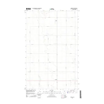
2014 Map of Renville
USGS Topo · Published 2014About this map
Renville anchors the southern portion of this northern Bottineau County landscape, situated where the rural road network converges in a typical North Dakota section-line grid. This 2014 survey reveals a region defined by extensive prairie potholes and small depressions that dot the terrain between the major thoroughfares of 26th Ave NW and 25th Ave NW. The presence of the Peterson Airstrip in the north-central portion of the map highlights the continued reliance on private aviation for transport across these isolated agricultural stretches. This map is particularly useful for understanding the modern distribution of homesteads and the precise alignment of the township road system, including 100th St NW at the northern boundary.
Find a feature on this map
14 named features on this map. Tap any name to fly to it.
Don’t see what you’re looking for? This feature index may not catch every label — zoom into the map to look around manually.
Map Details
Editions of this 2014 Renville Map
This is the sole edition of this map. No revisions or reprints were ever made.
Other maps of this area

1948 · Dokken SW
USGS Topo · 1:24,000

1948 · Lansford
USGS Topo · 1:62,500

1949 · Lansford NW
USGS Topo · 1:24,000

1949 · Lansford NE
USGS Topo · 1:24,000

1949 · Maxbass
USGS Topo · 1:24,000

1949 · Westhope SW
USGS Topo · 1:24,000

1950 · Lansford
USGS Topo · 1:62,500

1950 · Westhope SW
USGS Topo · 1:24,000

1950 · Antler NW
USGS Topo · 1:24,000

1950 · Antler
USGS Topo · 1:24,000