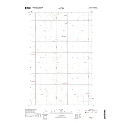
2017 Map of Renville
USGS Topo · Published 2017About this map
The small settlement of Renville serves as the focal point for this section of Bottineau County, where the agricultural grid meets the nascent energy infrastructure of the High Plains. This 2017 survey shows a landscape organized by a precise network of section-line roads, such as 93rd St NW, which facilitate both traditional farming and modern industrial access. The presence of Oil Field Rd and Oil Well Rd in the southeastern quadrant indicates the shifting economic character of the region as petroleum exploration integrates with the existing wheat and sunflower fields. Near the northern boundary, the Bethel Lutheran Brethren Cem stands as a quiet marker of the community's heritage, while the Peterson Airstrip suggests the practical necessity of private aviation in these broad, open expanses. To the southwest, the wandering path of Cut Bank Cr provides a rare break in the geometric regularity of the North Dakota prairie.
Find a feature on this map
19 named features on this map. Tap any name to fly to it.
Don’t see what you’re looking for? This feature index may not catch every label — zoom into the map to look around manually.
Map Details
Editions of this 2017 Renville Map
This is the sole edition of this map. No revisions or reprints were ever made.
Other maps of this area

1948 · Dokken SW
USGS Topo · 1:24,000

1948 · Lansford
USGS Topo · 1:62,500

1949 · Lansford NW
USGS Topo · 1:24,000

1949 · Lansford NE
USGS Topo · 1:24,000

1949 · Maxbass
USGS Topo · 1:24,000

1949 · Westhope SW
USGS Topo · 1:24,000

1950 · Lansford
USGS Topo · 1:62,500

1950 · Westhope SW
USGS Topo · 1:24,000

1950 · Antler NW
USGS Topo · 1:24,000

1950 · Antler
USGS Topo · 1:24,000