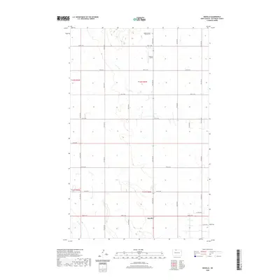
2020 Map of Renville
USGS Topo · Published 2020About this map
The small settlement of Renville sits at the southern edge of this Bottineau County landscape, where the prairie is defined by a grid of rural roads and the winding path of Cut Bank Cr. This section of the North Dakota borderlands reflects the long-standing agricultural and industrial patterns of the region, anchored by local landmarks like the Peterson Airstrip and the Bethel Lutheran Brethren Cem to the north. The presence of Oil Field Rd and Oil Well Rd in the eastern townships points to the energy extraction that characterizes this portion of the Williston Basin. Surveyed by the U.S. Geological Survey, the map provides a precise view of the section lines and township boundaries, including t162n r82w and t161n r83w, that have organized this landscape since the early days of settlement.
Find a feature on this map
18 named features on this map. Tap any name to fly to it.
Don’t see what you’re looking for? This feature index may not catch every label — zoom into the map to look around manually.
Map Details
Editions of this 2020 Renville Map
This is the sole edition of this map. No revisions or reprints were ever made.
Other maps of this area

1948 · Dokken SW
USGS Topo · 1:24,000

1948 · Lansford
USGS Topo · 1:62,500

1949 · Lansford NW
USGS Topo · 1:24,000

1949 · Lansford NE
USGS Topo · 1:24,000

1949 · Maxbass
USGS Topo · 1:24,000

1949 · Westhope SW
USGS Topo · 1:24,000

1950 · Lansford
USGS Topo · 1:62,500

1950 · Westhope SW
USGS Topo · 1:24,000

1950 · Antler NW
USGS Topo · 1:24,000

1950 · Antler
USGS Topo · 1:24,000