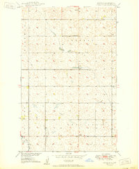
1950 Map of Renville
USGS Topo · Published 1950About this map
Renville anchors this mid-century survey of the North Dakota landscape, a region defined by the section lines and township boundaries of Sherman, Hoffman, Bank, and Renville townships. The map was produced as part of the Department of the Interior program for the development of the Missouri River Basin, capturing a moment when rural infrastructure supported a sparse but established agricultural community. The terrain is marked by numerous small depressions and ponds characteristic of the prairie pothole region, with Cut Bank Creek providing the primary drainage in the southwestern corner. Social and community life are grounded in the presence of School No 1 and Bethel Ch, which served the outlying farmsteads during this era of post-war development. The survey reflects a transition in mapping technology, utilizing aerial photography from 1948 to supplement traditional plane-table methods.
Find a feature on this map
10 named features on this map. Tap any name to fly to it.
Don’t see what you’re looking for? This feature index may not catch every label — zoom into the map to look around manually.
Map Details
Editions of this 1950 Renville Map
This is the sole edition of this map. No revisions or reprints were ever made.
Other maps of this area

1948 · Dokken SW
USGS Topo · 1:24,000

1948 · Lansford
USGS Topo · 1:62,500

1949 · Lansford NW
USGS Topo · 1:24,000

1949 · Lansford NE
USGS Topo · 1:24,000

1949 · Maxbass
USGS Topo · 1:24,000

1949 · Westhope SW
USGS Topo · 1:24,000

1950 · Lansford
USGS Topo · 1:62,500

1950 · Westhope SW
USGS Topo · 1:24,000

1950 · Antler NW
USGS Topo · 1:24,000

1950 · Antler
USGS Topo · 1:24,000