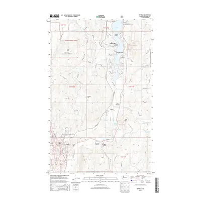
2014 Map of Republic
USGS Topo · Published 2014About this map
Republic sits at the southern edge of this 2014 survey, serving as a hub for the surrounding timber and mining country. The landscape is defined by the Sanpoil River valley and the extensive Curlew Lake, which is dotted with islands like Zipphel Island and Wiseman Island. As a modern record of the area, the map shows the transition from the mountainous terrain of Klondike Mtn and Bald Peak to the developed recreational corridors along Wa-21. Local infrastructure is well-documented, including the Ferry County Airport, Eagle Track Raceway, and the Ferry County Fairgrounds near Pine Grove. Genealogists and historians will find the Old Cemetery north of the main townsite, while the northern reaches of the quadrangle are largely contained within the Colville National Forest, where smaller settlements like Pollard and Torboy line the lakeshore.
Find a feature on this map
105 named features on this map. Tap any name to fly to it.
Don’t see what you’re looking for? This feature index may not catch every label — zoom into the map to look around manually.
Map Details
Editions of this 2014 Republic Map
This is the sole edition of this map. No revisions or reprints were ever made.
Other maps of this area

1904 · Republic
USGS Topo · 1:125,000

1948 · Curlew
USGS Topo · 1:62,500

1948 · Republic
USGS Topo · 1:62,500

1951 · Wauconda
USGS Topo · 1:62,500

1951 · Curlew
USGS Topo · 1:62,500

1951 · Bodie Mountain
USGS Topo · 1:62,500

1951 · Republic
USGS Topo · 1:62,500

1954 · Okanogan
USGS Topo · 1:250,000

1958 · Okanogan
USGS Topo · 1:250,000

1958 · Aeneas
USGS Topo · 1:62,500