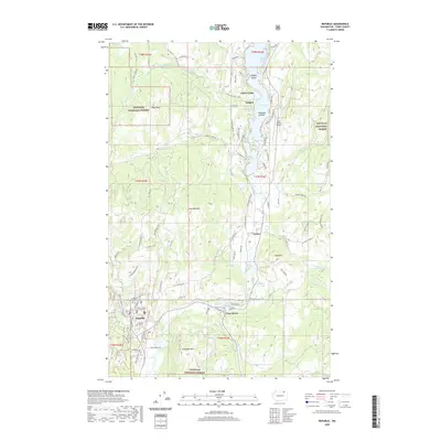
2020 Map of Republic
USGS Topo · Published 2020About this map
Republic serves as the focal point of this Ferry County study, anchored by the Ferry County Courthouse and situated at the junction of several drainage systems. The landscape is defined by the high elevations of the Colville National Forest, where peaks like Klondike Mtn and Gibraltar Mtn tower over the valleys. The north-south orientation of the Sanpoil River and its accompanying lakes—including Mud Lake, Sanpoil Lake, and Turner Lake—demonstrates the region's hydrographic network that funnels water through the mountain gaps.
Find a feature on this map
93 named features on this map. Tap any name to fly to it.
Don’t see what you’re looking for? This feature index may not catch every label — zoom into the map to look around manually.
Map Details
Editions of this 2020 Republic Map
This is the sole edition of this map. No revisions or reprints were ever made.
Other maps of this area

1904 · Republic
USGS Topo · 1:125,000

1948 · Curlew
USGS Topo · 1:62,500

1948 · Republic
USGS Topo · 1:62,500

1951 · Wauconda
USGS Topo · 1:62,500

1951 · Curlew
USGS Topo · 1:62,500

1951 · Bodie Mountain
USGS Topo · 1:62,500

1951 · Republic
USGS Topo · 1:62,500

1954 · Okanogan
USGS Topo · 1:250,000

1958 · Okanogan
USGS Topo · 1:250,000

1958 · Aeneas
USGS Topo · 1:62,500