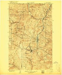
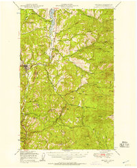
1904 Map of Republic
USGS Topo · Published 1917About this map
Republic serves as the focal point of this northern Washington survey, captured at a peak of early 20th-century mineral extraction. The town sits at the center of a dense cluster of claims and operations including the Mountain Lion Mine, Tom Thumb Mine, and California Mine, which spurred rapid development in the Sanpoil River valley. To the north, the Great Northern Railway snakes through the valley of Curlew Creek, connecting settlements like Curlew, Malo, and Pollard to the United States-Canada Boundary Line at Danville. The landscape transitions from industrial mining sites to the protected tracts of the Colville National Forest. Genealogists may find value in the distinction between Wauconda and Old Wauconda, while the numerous mountain peaks like Gibraltar Mt. and Copper Mt. illustrate the challenging terrain that shaped the region's transport network, including the Belcher Mine Road.
Find a feature on this map
111 named features on this map. Tap any name to fly to it.
Don’t see what you’re looking for? This feature index may not catch every label — zoom into the map to look around manually.
Map Details
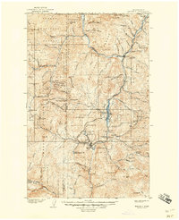
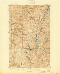
Editions of this 1904 Republic Map
4 editions found
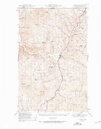
Other maps of this area

1902 · Osoyoos
USGS Topo · 1:125,000

1904 · Osoyoos
USGS Topo · 1:125,000

1904 · Republic
USGS Topo · 1:125,000

1936 · Marcus
USGS Topo · 1:96,000

1942 · Marcus
USGS Topo · 1:125,000
1948 · Curlew
USGS Topo · 1:62,500
1948 · Republic
USGS Topo · 1:62,500
1948 · Sherman Peak
USGS Topo · 1:62,500
1948 · Togo Mountain
USGS Topo · 1:62,500
1951 · Wauconda
USGS Topo · 1:62,500