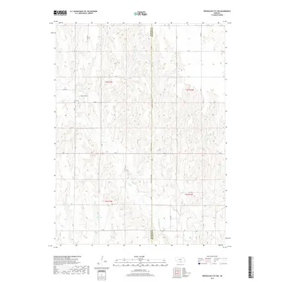
2017 Map of Republican City NW
USGS Topo · Published 2017About this map
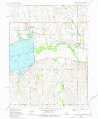
Harlan and Franklin counties meet along a straight meridian in this agricultural landscape of south-central Nebraska. The drainage pattern is defined by the winding course of Turkey Cr, which cuts through the central sections, and Eureka Cr to the south. This era of land management is marked by numerous small-scale water impoundments, including Harms Reservoir, Ziegler Reservoir, and Ott Reservoir, which dot the rolling sections of the Republican River watershed.
Find a feature on this map
37 named features on this map. Tap any name to fly to it.
Don’t see what you’re looking for? This feature index may not catch every label — zoom into the map to look around manually.
Map Details
Editions of this 2017 Republican City NW Map
This is the sole edition of this map. No revisions or reprints were ever made.
Other maps of this area

1896 · Holdrege
USGS Topo · 1:125,000

1955 · Grand Island
USGS Topo · 1:250,000

1957 · Grand Island
USGS Topo · 1:250,000

1958 · Grand Island
USGS Topo · 1:250,000

1970 · Wilcox
USGS Topo · 1:24,000

1970 · Ragan
USGS Topo · 1:24,000
1970 · Hildreth
USGS Topo · 1:24,000
1973 · Republican City NE
USGS Topo · 1:24,000
1973 · Bloomington
USGS Topo · 1:24,000
1974 · Republican City
USGS Topo · 1:24,000