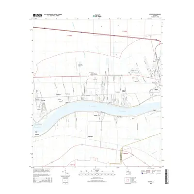
2015 Map of Reserve
USGS Topo · Published 2015About this map
The Mississippi River defines the geography of this corridor, where a string of riverfront settlements like Reserve, Lions, and Garyville trace the winding levees. This landscape is a patchwork of industrial sites, residential street grids, and extensive drainage works such as the Reserve Relief Canal and Moll Canal. The map reveals the institutional and civic infrastructure of St. John the Baptist Parish, including the Louisiana Technical College-River Parishes Campus and the St John the Baptist Parish Airport. Genealogists and local historians can locate long-standing religious and burial sites like the Saint John the Baptist Cem in Edgard and the Bishop Cem near Dolsen. From the industrial developments at Marathon to the smaller hamlets of Tigerville and Lucy, the map documents the complex relationship between the heavy navigation of the river and the communities that flank it.
Find a feature on this map
124 named features on this map. Tap any name to fly to it.
Don’t see what you’re looking for? This feature index may not catch every label — zoom into the map to look around manually.
Map Details
Editions of this 2015 Reserve Map
This is the sole edition of this map. No revisions or reprints were ever made.
Other maps of this area

1891 · Hahnville
USGS Topo · 1:62,500

1892 · Lac Des Allemands
USGS Topo · 1:62,500

1892 · Mount Airy
USGS Topo · 1:62,500

1892 · Bonnet Carre
USGS Topo · 1:62,500

1932 · Lac Des Allemands NW
USGS Topo · 1:31,680

1932 · Hahnville NW
USGS Topo · 1:31,680

1932 · Lac Des Allemands NE
USGS Topo · 1:31,680

1935 · Laplace
USGS Topo · 1:31,680

1936 · Hahnville
USGS Topo · 1:31,680

1936 · Ruddock
USGS Topo · 1:31,680