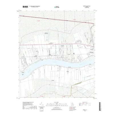
2018 Map of Reserve
USGS Topo · Published 2018About this map
The Mississippi River creates a dramatic curve through this landscape, dividing the riverfront communities of Reserve, Marathon, and Cornland on the north bank from Edgard, Lucy, and Columbia to the south. This 2018 survey documents a region where industry and infrastructure closely track the river's edge, including the Port of South Louisiana Executive Regional Airport and the South Central Louisiana Technical College Reserve Campus.
Find a feature on this map
132 named features on this map. Tap any name to fly to it.
Don’t see what you’re looking for? This feature index may not catch every label — zoom into the map to look around manually.
Map Details
Editions of this 2018 Reserve Map
This is the sole edition of this map. No revisions or reprints were ever made.
Other maps of this area

1891 · Hahnville
USGS Topo · 1:62,500

1892 · Lac Des Allemands
USGS Topo · 1:62,500

1892 · Mount Airy
USGS Topo · 1:62,500

1892 · Bonnet Carre
USGS Topo · 1:62,500

1932 · Lac Des Allemands NW
USGS Topo · 1:31,680

1932 · Hahnville NW
USGS Topo · 1:31,680

1932 · Lac Des Allemands NE
USGS Topo · 1:31,680

1935 · Laplace
USGS Topo · 1:31,680

1936 · Hahnville
USGS Topo · 1:31,680

1936 · Ruddock
USGS Topo · 1:31,680