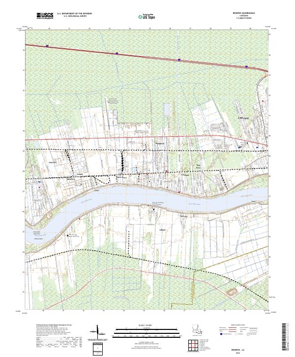
2024 Map of Reserve
USGS Topo · Published 2024About this map
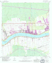
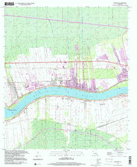
The Mississippi River carves through the heart of St. John the Baptist Parish, defining the industrial and agricultural rhythm of this riverbank landscape. On the east bank, the settlement of Reserve is a dense cluster of industry and education, anchored by the River Parishes Community College - Reserve Campus and the nearby Port of South Louisiana Executive Regional Airport. Surrounding neighborhoods like Dutch Bayou, Belle Point, and Garyville stretch along the river's curve, interspersed with historic burial grounds such as Bishop Cem and the Saint Peter Catholic Church Cem.
Find a feature on this map
148 named features on this map. Tap any name to fly to it.
Don’t see what you’re looking for? This feature index may not catch every label — zoom into the map to look around manually.
Map Details
Editions of this 2024 Reserve Map
This is the sole edition of this map. No revisions or reprints were ever made.
Historical Maps of Hope Through Time
3 maps found