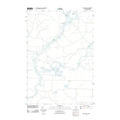
2011 Map of Resort Lake
USGS Topo · Published 2011About this map
The Menominee River forms a major hydrologic spine through this landscape, serving as the border between Wisconsin and Michigan. The river's flow is managed by the White Rapids Dam, which creates a complex series of islands including Sixty Islands and Round Island. The interior is defined by a dense concentration of glacial water bodies, with Resort Lake, East Lake, and Baker Lake forming a central cluster. Local history is anchored by the Lost Lake Cemetery and Chalk Hill Camp in the northern reaches. This 2011 survey by the U.S. Geological Survey illustrates a region heavily shaped by its waterways and small inland lakes, such as Muskrat Lake and Osborn Lake, which remain primary features of the local topography.
Find a feature on this map
30 named features on this map. Tap any name to fly to it.
Don’t see what you’re looking for? This feature index may not catch every label — zoom into the map to look around manually.
Map Details
Editions of this 2011 Resort Lake Map
This is the sole edition of this map. No revisions or reprints were ever made.
Other maps of this area

1939 · Pembine
USGS Topo · 1:48,000

1942 · Wausaukee
USGS Topo · 1:48,000

1947 · Pembine
USGS Topo · 1:48,000

1947 · Wausaukee
USGS Topo · 1:48,000

1949 · Stephenson
USGS Topo · 1:48,000

1954 · Escanaba
USGS Topo · 1:250,000

1957 · Escanaba
USGS Topo · 1:250,000

1958 · Escanaba
USGS Topo · 1:250,000

1963 · Pembine
USGS Topo · 1:62,500

1963 · Powers
USGS Topo · 1:62,500