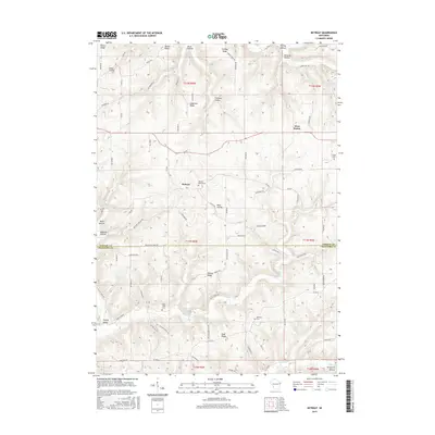
2015 Map of Retreat
USGS Topo · Published 2015About this map
The ridge-and-valley landscape of the Driftless Area is clearly defined along the border of Vernon and Crawford counties, where the settlement of Retreat serves as a central landmark. The terrain is characterized by a series of prominent elevations and deep hollows, including Bishop Ridge, Nash Ridge, and Torgerson Hollow, which dictate the winding paths of rural routes like Bolstad Ave and Rush Creek Rd. This 2015 survey reveals a quiet agricultural pattern with small communities like West Prairie interspersed among family-named landmarks and cemeteries.
Find a feature on this map
83 named features on this map. Tap any name to fly to it.
Don’t see what you’re looking for? This feature index may not catch every label — zoom into the map to look around manually.
Map Details
Editions of this 2015 Retreat Map
This is the sole edition of this map. No revisions or reprints were ever made.
Other maps of this area

1903 · Waukon
USGS Topo · 1:125,000

1923 · Viroqua
USGS Topo · 1:62,500

1924 · Gays Mills
USGS Topo · 1:62,500

1926 · Gays Mills
USGS Topo · 1:62,500

1926 · Stoddard
USGS Topo · 1:62,500

1926 · Viroqua
USGS Topo · 1:62,500

1929 · Ferryville
USGS Topo · 1:62,500

1932 · Ferryville
USGS Topo · 1:62,500

1958 · La Crosse
USGS Topo · 1:250,000

1961 · La Crosse
USGS Topo · 1:250,000