2018 Map of Retreat
USGS Topo · Published 2018About this map
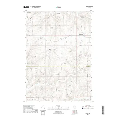
Retreat and West Prairie anchor this corner of the Driftless Area, where the boundary between Vernon Co and Crawford Co cuts across high, dissected plateaus. The landscape is defined by its dramatic ridges and hollows, including Bishop Ridge, Nash Ridge, and Tewalt Ridge, which separate the drainage systems of Rush Cr and Sugar Cr. For genealogists and local historians, several small burial grounds are meticulously documented, such as Walnut Mound Cem, Fargo Cem, and Rush Creek Cem, indicating the scattered settlement patterns of these rural townships. The map illustrates a dense network of country roads following the contour of the land, from the winding Bohland Hollow Rd to the straighter ridge-top paths like Devonport Ridge Rd. In the south, the Turkey Bluff Airport sits on a high bench, providing a modern landmark amidst the traditional agricultural terrain of Cooley Valley and Frohock Valley.
Find a feature on this map
78 named features on this map. Tap any name to fly to it.
Don’t see what you’re looking for? This feature index may not catch every label — zoom into the map to look around manually.
Map Details
Editions of this 2018 Retreat Map
This is the sole edition of this map. No revisions or reprints were ever made.
Other maps of this area

1903 · Waukon
USGS Topo · 1:125,000

1923 · Viroqua
USGS Topo · 1:62,500

1924 · Gays Mills
USGS Topo · 1:62,500

1926 · Gays Mills
USGS Topo · 1:62,500

1926 · Stoddard
USGS Topo · 1:62,500

1926 · Viroqua
USGS Topo · 1:62,500

1929 · Ferryville
USGS Topo · 1:62,500

1932 · Ferryville
USGS Topo · 1:62,500

1958 · La Crosse
USGS Topo · 1:250,000

1961 · La Crosse
USGS Topo · 1:250,000