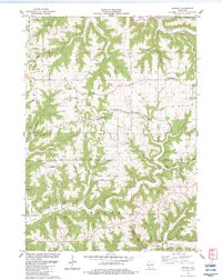
1983 Map of Retreat
USGS Topo · Published 1983About this map
The unincorporated community of Retreat anchors this topographical study of the Driftless Area during the early 1980s. The landscape is defined by its characteristic ridges and deep valleys, including the prominent Bishop Ridge and Anderson Ridge, which separate the drainages of the Bad Axe River to the north and Rush Creek to the south. This terrain dictated a settlement pattern of ridge-top farms and winding hollow roads, such as Hayden Road and Everson Road.
Find a feature on this map
47 named features on this map. Tap any name to fly to it.
Don’t see what you’re looking for? This feature index may not catch every label — zoom into the map to look around manually.
Map Details
Editions of this 1983 Retreat Map
This is the sole edition of this map. No revisions or reprints were ever made.
Other maps of this area

1903 · Waukon
USGS Topo · 1:125,000

1923 · Viroqua
USGS Topo · 1:62,500

1924 · Gays Mills
USGS Topo · 1:62,500

1926 · Gays Mills
USGS Topo · 1:62,500

1926 · Stoddard
USGS Topo · 1:62,500

1926 · Viroqua
USGS Topo · 1:62,500

1929 · Ferryville
USGS Topo · 1:62,500

1932 · Ferryville
USGS Topo · 1:62,500

1958 · La Crosse
USGS Topo · 1:250,000

1961 · La Crosse
USGS Topo · 1:250,000