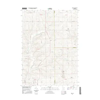
2016 Map of Rewey
USGS Topo · Published 2016About this map
Rewey serves as the primary settlement in this southwestern Wisconsin landscape, situated at the intersection of Co Rd A and Co Rd G. The terrain is defined by the prominent Platte Mounds and the smaller Little Mound to the southeast, while the Little Platte River and its tributaries, including Mounds Br and Williams-Rewey Br, carve the rural countryside. This 2016 survey documents a region of deep agricultural and genealogical significance, preserving the locations of early burial grounds such as Lydia Cem, McReynolds Cem, and Kirkpatrick Cem. The survey illustrates a well-established network of rural roads like Cushman Rd and Mockingbird Rd that connect isolated farmsteads across the borders of Grant, Iowa, and Lafayette counties.
Find a feature on this map
68 named features on this map. Tap any name to fly to it.
Don’t see what you’re looking for? This feature index may not catch every label — zoom into the map to look around manually.
Map Details
Editions of this 2016 Rewey Map
This is the sole edition of this map. No revisions or reprints were ever made.
Other maps of this area

1900 · Lancaster
USGS Topo · 1:125,000

1902 · Mineral Point
USGS Topo · 1:125,000

1904 · Lancaster
USGS Topo · 1:125,000

1908 · Lancaster
USGS Topo · 1:125,000

1952 · Platteville
USGS Topo · 1:24,000

1952 · Rewey
USGS Topo · 1:24,000

1952 · Montfort
USGS Topo · 1:24,000

1952 · Belmont
USGS Topo · 1:24,000

1952 · Linden
USGS Topo · 1:24,000

1952 · Mifflin
USGS Topo · 1:24,000