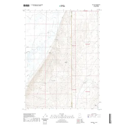
2020 Map of Rex Peak
USGS Topo · Published 2020About this map
The Crawford Mountains rise sharply above the river bottomlands where the Utah Wyoming border cuts through the high desert. This landscape is defined by the vital management of water, evidenced by the complex irrigation network of the Beckwith and Quinn Canal, Rex Canal, and Crawford Thompson Canal which divert flows from the Bear River and Otter Cr. These engineering feats allowed for the expansion of ranching and agriculture into the arid valleys surrounding Rex Peak. Along the eastern slopes of the range, numerous natural water sources like Brazier Spring and Poison Spring punctuate the dry terrain of Coal Hollow and Brazier Canyon. The map reveals the intricate intersection of state and county lines, as the boundary between Rich Co and Lincoln Co follows the crests and valleys through Warner Hollow and Dry Hollow.
Find a feature on this map
30 named features on this map. Tap any name to fly to it.
Don’t see what you’re looking for? This feature index may not catch every label — zoom into the map to look around manually.
Map Details
Editions of this 2020 Rex Peak Map
This is the sole edition of this map. No revisions or reprints were ever made.
Other maps of this area

1912 · Randolph
USGS Topo · 1:125,000

1954 · Sage
USGS Topo · 1:62,500

1954 · Ogden
USGS Topo · 1:250,000

1958 · Ogden
USGS Topo · 1:250,000

1960 · Ogden
USGS Topo · 1:250,000

1962 · Sawtooth Mountain
USGS Topo · 1:24,000

1962 · Windy Point
USGS Topo · 1:24,000

1968 · Rex Peak
USGS Topo · 1:24,000

1968 · Randolph
USGS Topo · 1:24,000

1968 · Woodruff
USGS Topo · 1:24,000