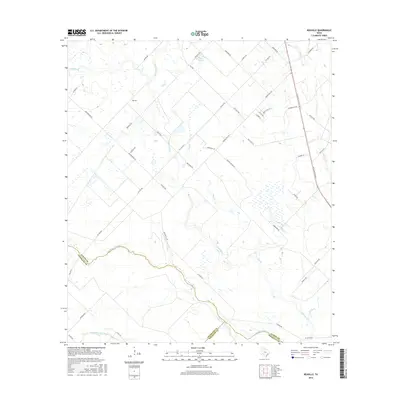
2016 Map of Rexville
USGS Topo · Published 2016About this map
The San Bernard River serves as a winding natural boundary where Austin, Colorado, and Wharton counties converge, anchoring a landscape defined by its intricate drainage network. Tributaries like Little Bernard Cr and Middle Bernard Cr crisscross the region, highlighting the alluvial character of this Texas coastal plain. The small settlement of Rexville is positioned near the center of a grid of rural roads, including Rexville Rd and Mieth Rd S, which reflect the area's agricultural divisions. To the east, the alignment of 36th Division Ave follows the regional rail corridor, while features like Lake Vinnau and Hog Br provide focal points for local topography. This survey captures the transition from open ranchland to more concentrated riverine environments before the modern expansion of nearby municipalities altered the rural textures of the county lines.
Find a feature on this map
49 named features on this map. Tap any name to fly to it.
Don’t see what you’re looking for? This feature index may not catch every label — zoom into the map to look around manually.
Map Details
Editions of this 2016 Rexville Map
This is the sole edition of this map. No revisions or reprints were ever made.
Other maps of this area

1953 · Seguin
USGS Topo · 1:250,000

1956 · Bellville
USGS Topo · 1:62,500

1956 · Sealy
USGS Topo · 1:62,500

1956 · Wallis
USGS Topo · 1:62,500

1957 · Eagle Lake
USGS Topo · 1:62,500

1958 · Seguin
USGS Topo · 1:250,000

1960 · Lissie
USGS Topo · 1:24,000

1960 · Wallis
USGS Topo · 1:24,000

1960 · San Felipe
USGS Topo · 1:24,000
1960 · East Bernard
USGS Topo · 1:24,000