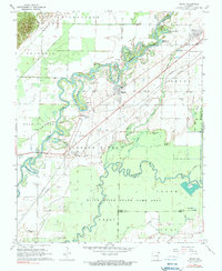
1968 Map of Reyno
USGS Topo · Published 1970About this map
The Current River and Black River meander through a landscape of oxbow lakes and wetlands in this late 1960s survey. Settlements like Reyno and Biggers occupy the higher ground between the river systems, while much of the southern territory is dedicated to the Black River State Game Area. The map reveals a history of changing transport and industry, from the Old Railroad Grade running northwest to the industrial presence of a Gas plant and Pumping Station near the river banks.
Find a feature on this map
47 named features on this map. Tap any name to fly to it.
Don’t see what you’re looking for? This feature index may not catch every label — zoom into the map to look around manually.
Map Details
Editions of this 1968 Reyno Map
2 editions found
Other maps of this area

1932 · Walnut Ridge
USGS Topo · 1:62,500

1935 · Knobel
USGS Topo · 1:62,500

1935 · Reyno
USGS Topo · 1:62,500

1935 · Walnut Ridge
USGS Topo · 1:62,500

1940 · Gainesville
USGS Topo · 1:62,500

1941 · Knobel
USGS Topo · 1:62,500

1957 · Poplar Bluff
USGS Topo · 1:250,000

1958 · Gainesville
USGS Topo · 1:62,500

1959 · Poplar Bluff
USGS Topo · 1:250,000
1960 · Gainesville
USGS Topo · 1:62,500