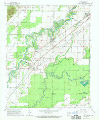
1968 Map of Reyno
USGS Topo · Published 1970About this map
Reyno and Biggers stand as the primary centers of settlement in this riverine landscape, where the Current River and Black River meander through the delta. The serpentine path of the Current River creates a complex network of oxbows and backwaters, including Peachtree Lake and Sparkman Lake, which historically dictated the pattern of agriculture and local transport. The presence of Richardson Ferry and the Old Railroad Grade illustrate the evolution of transit across these bottomlands, while the St Louis-San Francisco RR provides the modern rail link through Biggers. For the local historian, the map preserves the locations of numerous family-named burial grounds such as Johnston Cem, Blount Cem, and Scott Cem. Near Pig Ridge, a solitary Indian Mound remains a visible landmark of early indigenous geography.
Find a feature on this map
54 named features on this map. Tap any name to fly to it.
Don’t see what you’re looking for? This feature index may not catch every label — zoom into the map to look around manually.
Map Details
Editions of this 1968 Reyno Map
2 editions found
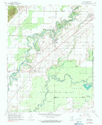
Other maps of this area

1932 · Walnut Ridge
USGS Topo · 1:62,500

1935 · Knobel
USGS Topo · 1:62,500

1935 · Reyno
USGS Topo · 1:62,500

1935 · Walnut Ridge
USGS Topo · 1:62,500

1940 · Gainesville
USGS Topo · 1:62,500

1941 · Knobel
USGS Topo · 1:62,500

1957 · Poplar Bluff
USGS Topo · 1:250,000

1958 · Gainesville
USGS Topo · 1:62,500

1959 · Poplar Bluff
USGS Topo · 1:250,000
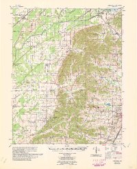
1960 · Gainesville
USGS Topo · 1:62,500