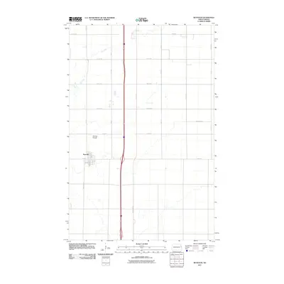
2011 Map of Reynolds
USGS Topo · Published 2011About this map
Reynolds occupies a central position within this Red River Valley landscape, serving as a primary settlement point along a grid of agricultural section lines and vital transit corridors. The town's layout is defined by residential streets like Sanborn St and Hubbard St, while the surrounding prairie is drained by the winding course of Cole Creek. North of the town center, the Americus-Saint Olaf Cemetery provides a specific point of interest for genealogists and local historians, reflecting the heritage of the early communities that established this part of Traill and Grand Forks counties. The map documents a highly structured rural environment where north-south thoroughfares like County Hwy 21 and County Hwy 81 facilitate movement through the expansive farmstead network of the eastern Dakotas.
Find a feature on this map
27 named features on this map. Tap any name to fly to it.
Don’t see what you’re looking for? This feature index may not catch every label — zoom into the map to look around manually.
Map Details
Editions of this 2011 Reynolds Map
This is the sole edition of this map. No revisions or reprints were ever made.
Other maps of this area

1919 · Eldred
USGS Topo · 1:62,500

1934 · Grand Forks
USGS Topo · 1:62,500

1938 · Grand Forks
USGS Topo · 1:62,500

1952 · Grand Forks
USGS Topo · 1:250,000

1956 · Grand Forks
USGS Topo · 1:250,000

1964 · Climax NW
USGS Topo · 1:24,000

1964 · Climax SW
USGS Topo · 1:24,000
1964 · Bygland
USGS Topo · 1:24,000

1966 · Grand Forks
USGS Topo · 1:250,000
1971 · Thompson
USGS Topo · 1:24,000