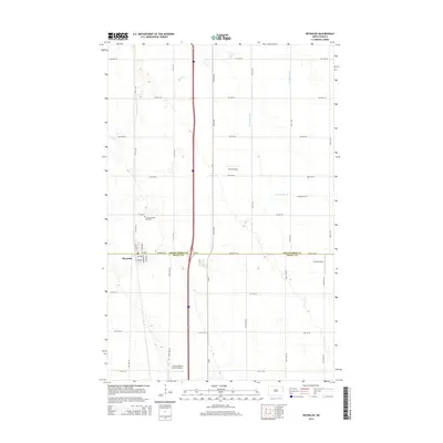
2014 Map of Reynolds
USGS Topo · Published 2014About this map
Reynolds sits at the intersection of local history and modern transport, straddling the boundary between Grand Forks Co and Traill Co. This agricultural landscape is meticulously organized by a grid of township roads and drainage systems like Drain Number 10 and Drain Number 27, which manage the water levels of the surrounding plains. The presence of the Americus-Saint Olaf Cem provides a focal point for genealogical research, while the town's layout, featuring Railway St and Sanborn St, points to its development along the rail corridor. Aviation plays a surprisingly prominent role in this rural area, with three distinct landing strips—Saure Airport, Jenson Airport, and the Central Valley Aviation Airport—scattered across the farmland, reflecting the scale and requirements of contemporary large-scale farming operations in the Red River Valley region.
Find a feature on this map
37 named features on this map. Tap any name to fly to it.
Don’t see what you’re looking for? This feature index may not catch every label — zoom into the map to look around manually.
Map Details
Editions of this 2014 Reynolds Map
This is the sole edition of this map. No revisions or reprints were ever made.
Other maps of this area

1919 · Eldred
USGS Topo · 1:62,500

1934 · Grand Forks
USGS Topo · 1:62,500

1938 · Grand Forks
USGS Topo · 1:62,500

1952 · Grand Forks
USGS Topo · 1:250,000

1956 · Grand Forks
USGS Topo · 1:250,000

1964 · Climax NW
USGS Topo · 1:24,000

1964 · Climax SW
USGS Topo · 1:24,000
1964 · Bygland
USGS Topo · 1:24,000

1966 · Grand Forks
USGS Topo · 1:250,000
1971 · Thompson
USGS Topo · 1:24,000