
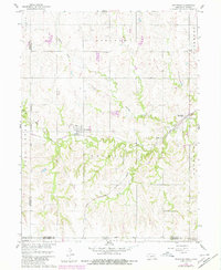
1960 Map of Reynolds
USGS Topo · Published 1961About this map
Reynolds serves as a central hub in Jefferson County during the early 1960s, situated at the intersection of a grid-patterned township system and the winding path of Rose Creek. This landscape is defined by the heavy presence of mid-century rail infrastructure, with the Chicago Burlington and Quincy and the Chicago Rock Island and Pacific railroads cutting through the terrain. The map captures the agricultural and social structure of the era, marked by rural schoolhouses such as School No 26 and School No 28. The distribution of these schools alongside cemeteries like Rose Creek Cem reflects a decentralized community layout typical of the Nebraska-Kansas borderlands before the consolidation of rural districts. The intricate drainage of Buckley Creek and Wiley Creek further illustrates the topographical challenges faced by early settlers and engineers in the Missouri River Basin.
Find a feature on this map
20 named features on this map. Tap any name to fly to it.
Don’t see what you’re looking for? This feature index may not catch every label — zoom into the map to look around manually.
Map Details
Editions of this 1960 Reynolds Map
2 editions found
Other maps of this area

1893 · Washington
USGS Topo · 1:125,000

1955 · Manhattan
USGS Topo · 1:250,000

1955 · Lincoln
USGS Topo · 1:250,000

1956 · Manhattan
USGS Topo · 1:250,000

1957 · Manhattan
USGS Topo · 1:250,000

1957 · Lincoln
USGS Topo · 1:250,000

1958 · Lincoln
USGS Topo · 1:250,000

1960 · Fairbury SW
USGS Topo · 1:24,000

1960 · Hubbell
USGS Topo · 1:24,000

1960 · Fairbury
USGS Topo · 1:24,000