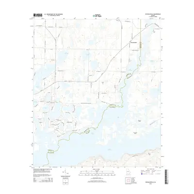
2014 Map of Reynoldsville
USGS Topo · Published 2014About this map
Lake Seminole dominates this southwest Georgia landscape, its vast backwaters defining the boundary between Seminole and Decatur counties. The small settlement of Reynoldsville sits north of the lake along the GA-253 corridor, serving as a hub for the various residential roads and boat landings that line the northern shore. The geography is characterized by a complex network of wetlands and smaller basins, including Whittakers Lake, Buffalo Pond, and Harvel Pond, all fed by local systems like Fishpond Drain.
Find a feature on this map
81 named features on this map. Tap any name to fly to it.
Don’t see what you’re looking for? This feature index may not catch every label — zoom into the map to look around manually.
Map Details
Editions of this 2014 Reynoldsville Map
This is the sole edition of this map. No revisions or reprints were ever made.
Other maps of this area

1954 · Steam Mill
USGS Topo · 1:24,000

1954 · Sneads
USGS Topo · 1:24,000

1954 · Desser
USGS Topo · 1:24,000

1954 · Tallahassee
USGS Topo · 1:250,000

1955 · Fairchild
USGS Topo · 1:24,000

1955 · Reynoldsville
USGS Topo · 1:24,000

1955 · Chattahoochee
USGS Topo · 1:24,000

1955 · Bainbridge
USGS Topo · 1:62,500

1955 · Mt Pleasant
USGS Topo · 1:24,000

1959 · Tallahassee
USGS Topo · 1:250,000