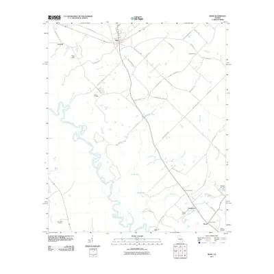
2011 Map of Rhine
USGS Topo · Published 2011About this map
The Ocmulgee River meanders through this landscape, defining the western and southern reaches of the territory near Rhine. This riverine environment is characterized by an intricate network of waterways, including Cypress Creek, Griffin Creek, and Mizell Creek, which feed into larger bodies like Spring Lake. The settlement pattern is largely rural, with clusters of activity around Sharon and Temperance in the southeast.
Find a feature on this map
54 named features on this map. Tap any name to fly to it.
Don’t see what you’re looking for? This feature index may not catch every label — zoom into the map to look around manually.
Map Details
Editions of this 2011 Rhine Map
This is the sole edition of this map. No revisions or reprints were ever made.
Other maps of this area

1953 · Waycross
USGS Topo · 1:250,000

1957 · Macon
USGS Topo · 1:250,000

1958 · Macon
USGS Topo · 1:250,000

1958 · Waycross
USGS Topo · 1:250,000

1964 · Macon
USGS Topo · 1:250,000

1972 · Cooks Still
USGS Topo · 1:24,000

1972 · Abbeville North
USGS Topo · 1:24,000
1972 · Milan
USGS Topo · 1:24,000

1972 · Lake Cypress
USGS Topo · 1:24,000

1972 · China Hill
USGS Topo · 1:24,000