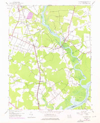
1944 Map of Rhodesdale
USGS Topo · Published 1976About this map
The Baltimore and Eastern railroad corridor defines the development of this Eastern Shore landscape, connecting inland agricultural hubs like Hurlock and Rhodesdale to the surrounding tidewater regions. During the mid-1940s, life centered on these rail junctions and the fertile lands between the Marshyhope Creek and the Nanticoke River. The map documents a period when small community anchors like Shiloh Ch and the Mission Sch served local families, while the river remained an active artery for transport at sites such as Ennalls Wharf and Walnut Landing. Near the southern edge, the tiny settlement of Riverton sits at the confluence where Big Marsh Creek meets the river, illustrating the transition from traditional water-based commerce to the rail-driven economy that reshaped the Maryland interior.
Find a feature on this map
31 named features on this map. Tap any name to fly to it.
Don’t see what you’re looking for? This feature index may not catch every label — zoom into the map to look around manually.
Map Details
Editions of this 1944 Rhodesdale Map
3 editions found
Other maps of this area

1901 · Salisbury
USGS Topo · 1:62,500

1903 · Nanticoke
USGS Topo · 1:62,500

1905 · Hurlock
USGS Topo · 1:62,500

1915 · Seaford
USGS Topo · 1:62,500

1942 · Mardela Springs
USGS Topo · 1:24,000

1942 · Hebron
USGS Topo · 1:24,000
1942 · Chicamacomico
USGS Topo · 1:24,000
1943 · Chicamacomico
USGS Topo · 1:31,680
1943 · Mardela Springs
USGS Topo · 1:31,680

1943 · Hebron
USGS Topo · 1:31,680