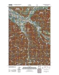
2011 Map of Rhododendron
USGS Topo · Published 2011About this map
The confluence of the Sandy River and the Zigzag River anchors this mountainous landscape in Clackamas County, illustrating the corridor of communities leading toward the high peaks. Several established mountain settlements follow the valley floor, including Wemme, Welches, and Zigzag, each supported by their own civic hubs like the Welches Post Office and Zigzag Post Office. The area's identity as a recreational gateway is evident through features such as the Mount Hood Golf Course and religious retreats like Camp Arrah Wanna.
Find a feature on this map
66 named features on this map. Tap any name to fly to it.
Don’t see what you’re looking for? This feature index may not catch every label — zoom into the map to look around manually.
Map Details
Editions of this 2011 Rhododendron Map
This is the sole edition of this map. No revisions or reprints were ever made.
Other maps of this area

1916 · Estacada
USGS Topo · 1:125,000

1924 · Mount Hood
USGS Topo · 1:125,000

1927 · Mount Hood
USGS Topo · 1:125,000

1948 · Vancouver
USGS Topo · 1:250,000

1950 · Vancouver
USGS Topo · 1:250,000

1950 · Vancouver
USGS Topo · 1:250,000

1953 · The Dalles
USGS Topo · 1:250,000

1955 · Cherryville
USGS Topo · 1:62,500

1956 · The Dalles
USGS Topo · 1:250,000

1956 · Fish Creek Mtn
USGS Topo · 1:62,500