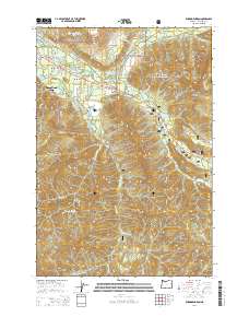
2014 Map of Rhododendron
USGS Topo · Published 2014About this map
Rhododendron and its neighboring villages serve as the central corridor through the Mount Hood National Forest along the Mount Hood Hwy. The landscape is defined by the convergence of major waterways, including the Sandy River, Zigzag River, and Salmon River, which carve through the high terrain of Zigzag Mtn and Hunchback Mtn. This mountain community structure, following the path of the historic E Barlow Trail Rd, reflects a long-standing reliance on the timber and recreation economy of Clackamas County. Notable infrastructure includes the Kloshe Chuck Reservoir and Lump Reservoir, which support the scattered settlements of Welches, Wemme, and Zigzag. Higher elevations are marked by landmarks like the Zigzag Lookout and the prominent Devils Peak, illustrating the transition from inhabited valley floors to the protected forest wilderness.
Find a feature on this map
73 named features on this map. Tap any name to fly to it.
Don’t see what you’re looking for? This feature index may not catch every label — zoom into the map to look around manually.
Map Details
Editions of this 2014 Rhododendron Map
This is the sole edition of this map. No revisions or reprints were ever made.
Other maps of this area

1916 · Estacada
USGS Topo · 1:125,000

1924 · Mount Hood
USGS Topo · 1:125,000

1927 · Mount Hood
USGS Topo · 1:125,000

1948 · Vancouver
USGS Topo · 1:250,000

1950 · Vancouver
USGS Topo · 1:250,000

1950 · Vancouver
USGS Topo · 1:250,000

1953 · The Dalles
USGS Topo · 1:250,000

1955 · Cherryville
USGS Topo · 1:62,500

1956 · The Dalles
USGS Topo · 1:250,000

1956 · Fish Creek Mtn
USGS Topo · 1:62,500