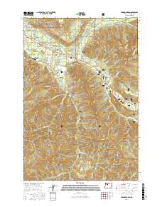
2017 Map of Rhododendron
USGS Topo · Published 2017About this map
Mount Hood National Forest dominates this terrain, where the Salmon River and Zigzag River converge among the steep ridges of the Cascade Range. The map illustrates a string of residential developments and recreation-focused communities along the highway corridor, including Rhododendron, Zigzag, Welches, and Wemme. This pattern of settlement reflects the area's long-standing role as a gateway for travelers and outdoor enthusiasts. Beyond the concentrated hubs of Mount Hood Village and Wildwood, the landscape rises sharply to landmarks such as Zigzag Mtn and Hunchback Mtn. Smaller water features like the Kloshe Chuck Reservoir and numerous creeks—Still Cr, Camp Cr, and Henry Cr—vein the forested slopes, while the West Zigzag Lookout provides a strategic vantage point over the drainage basins. Historical transit routes are evidenced by the E Barlow Trail Rd and E Emigrant Trl, grounding the modern landscape in its pioneer-era origins.
Find a feature on this map
69 named features on this map. Tap any name to fly to it.
Don’t see what you’re looking for? This feature index may not catch every label — zoom into the map to look around manually.
Map Details
Editions of this 2017 Rhododendron Map
This is the sole edition of this map. No revisions or reprints were ever made.
Other maps of this area

1916 · Estacada
USGS Topo · 1:125,000

1924 · Mount Hood
USGS Topo · 1:125,000

1927 · Mount Hood
USGS Topo · 1:125,000

1948 · Vancouver
USGS Topo · 1:250,000

1950 · Vancouver
USGS Topo · 1:250,000

1950 · Vancouver
USGS Topo · 1:250,000

1953 · The Dalles
USGS Topo · 1:250,000

1955 · Cherryville
USGS Topo · 1:62,500

1956 · The Dalles
USGS Topo · 1:250,000

1956 · Fish Creek Mtn
USGS Topo · 1:62,500