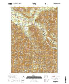
2020 Map of Rhododendron
USGS Topo · Published 2020About this map
Zigzag and Rhododendron anchor this mountain landscape within the Mount Hood National Forest, where residential developments are concentrated along the corridor of the Zigzag River. The map reveals a dense network of local roads and community clusters such as Wemme, Welches, and Mount Hood Village, illustrating the long-standing recreational and residential appeal of the area. Significant topographical features like Zigzag Mtn and Hunchback Mtn dominate the northern and eastern reaches, while the Salmon Wild and Scenic River defines the southern drainage. Historical travel is evidenced by the Pioneer Bridle trail and E Barlow Trail Rd, marking the enduring path of westward migration. Other notable landmarks include the Mountain Air Park and the distinct geological bench at Crutcher Bench, situated above the Sandy River.
Find a feature on this map
94 named features on this map. Tap any name to fly to it.
Don’t see what you’re looking for? This feature index may not catch every label — zoom into the map to look around manually.
Map Details
Editions of this 2020 Rhododendron Map
This is the sole edition of this map. No revisions or reprints were ever made.
Other maps of this area

1916 · Estacada
USGS Topo · 1:125,000

1924 · Mount Hood
USGS Topo · 1:125,000

1927 · Mount Hood
USGS Topo · 1:125,000

1948 · Vancouver
USGS Topo · 1:250,000

1950 · Vancouver
USGS Topo · 1:250,000

1950 · Vancouver
USGS Topo · 1:250,000

1953 · The Dalles
USGS Topo · 1:250,000

1955 · Cherryville
USGS Topo · 1:62,500

1956 · The Dalles
USGS Topo · 1:250,000

1956 · Fish Creek Mtn
USGS Topo · 1:62,500