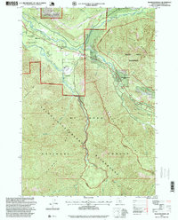
1997 Map of Rhododendron
USGS Topo · Published 1999About this map
Rhododendron and its neighboring villages serve as the gateway to the high Cascades along the Sandy River corridor during the late 1990s. The settlement pattern here reflects the long history of recreation and travel toward the mountain, evidenced by established landmarks like Camp Arrah Wanna, the Mt Hood Golf Course, and the Wildwood Recreation Site. While modern roads dominate the valley floor, older routes are preserved in the landscape through the Pioneer Bridle Trail and the noted Tollgate, which recall the difficult passage taken by earlier travelers.
Find a feature on this map
49 named features on this map. Tap any name to fly to it.
Don’t see what you’re looking for? This feature index may not catch every label — zoom into the map to look around manually.
Map Details
Editions of this 1997 Rhododendron Map
This is the sole edition of this map. No revisions or reprints were ever made.
Other maps of this area

1916 · Estacada
USGS Topo · 1:125,000

1924 · Mount Hood
USGS Topo · 1:125,000

1927 · Mount Hood
USGS Topo · 1:125,000

1948 · Vancouver
USGS Topo · 1:250,000

1950 · Vancouver
USGS Topo · 1:250,000

1950 · Vancouver
USGS Topo · 1:250,000

1953 · The Dalles
USGS Topo · 1:250,000

1955 · Cherryville
USGS Topo · 1:62,500

1956 · The Dalles
USGS Topo · 1:250,000

1956 · Fish Creek Mtn
USGS Topo · 1:62,500