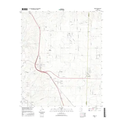
2016 Map of Rhome
USGS Topo · Published 2016About this map
Rhome and New Fairview anchor this Wise County landscape where suburban expansion meets legacy Texas ranch land. This 2016 survey documents a complex network of residential developments, such as those along Conestoga Trl and Audra Cir, which contrast with the older rural layout of the region. The map captures the significant transportation corridor of highway 81 287, which facilitates the area's growth between the smaller communities of Aurora and Newark. Aviation plays a notable role in the local infrastructure, with Fairview Airport, Howard Field, and JW Airport all serving the immediate vicinity.
Find a feature on this map
122 named features on this map. Tap any name to fly to it.
Don’t see what you’re looking for? This feature index may not catch every label — zoom into the map to look around manually.
Map Details
Editions of this 2016 Rhome Map
This is the sole edition of this map. No revisions or reprints were ever made.
Other maps of this area

1891 · Weatherford
USGS Topo · 1:125,000

1893 · Weatherford
USGS Topo · 1:125,000

1894 · Fort Worth
USGS Topo · 1:125,000

1924 · Sunset 4-d
USGS Topo · 1:48,000

1930 · Boyd
USGS Topo · 1:62,500

1932 · Springtown
USGS Topo · 1:62,500

1954 · Dallas
USGS Topo · 1:250,000

1954 · Sherman
USGS Topo · 1:250,000

1955 · Avondale
USGS Topo · 1:24,000

1955 · Azle
USGS Topo · 1:24,000