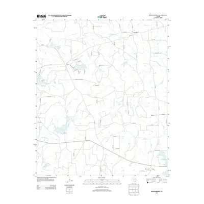
2012 Map of Rhonesboro
USGS Topo · Published 2012About this map
Perryville and Rhonesboro anchor the eastern side of this Wood County landscape, where the terrain is defined by a dense network of tributaries flowing toward Little Cypress Cr. The settlement pattern reflects a deeply rooted rural community, with small hubs like Ogburn and Holly Springs connected by a web of county roads. Genealogists will find notable burial sites such as Smith Cem near the headwaters of Turkey Cr and Robert Cem further south. The map shows significant water management and recreation features, including Gunstream Lake Number 1 and the grounds of Camp Deer Run. The presence of the Brockett Tree Farm Rd highlights the local importance of timber and land management in this part of East Texas.
Find a feature on this map
79 named features on this map. Tap any name to fly to it.
Don’t see what you’re looking for? This feature index may not catch every label — zoom into the map to look around manually.
Map Details
Editions of this 2012 Rhonesboro Map
This is the sole edition of this map. No revisions or reprints were ever made.
Other maps of this area

1956 · Tyler
USGS Topo · 1:250,000

1960 · Shady Grove
USGS Topo · 1:24,000

1960 · Pritchett
USGS Topo · 1:24,000

1960 · Hainesville
USGS Topo · 1:24,000

1960 · Winnsboro
USGS Topo · 1:24,000

1960 · Cartwright
USGS Topo · 1:24,000

1960 · Thomas
USGS Topo · 1:24,000

1960 · Newsome
USGS Topo · 1:24,000

1960 · Leesburg
USGS Topo · 1:24,000

1960 · Rhonesboro
USGS Topo · 1:24,000