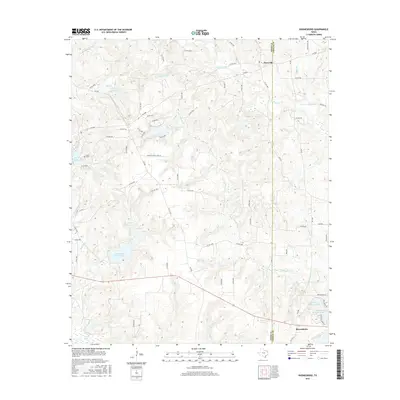
2016 Map of Rhonesboro
USGS Topo · Published 2016About this map
Rhonesboro and Perryville anchor this 2016 survey of the Wood and Upshur County line in East Texas. The landscape is defined by the headwaters and tributaries of Little Cypress Cr, which weaves through the terrain alongside numerous named water bodies including Gunstream Lake Number 1, Gunstream Lake Number 2, and Johnson Lake. This region reflects a complex network of private and county roads servicing rural homesteads and agricultural operations, such as Brockett Tree Farm Rd, which indicate the area's continued reliance on timber and land management.
Find a feature on this map
85 named features on this map. Tap any name to fly to it.
Don’t see what you’re looking for? This feature index may not catch every label — zoom into the map to look around manually.
Map Details
Editions of this 2016 Rhonesboro Map
This is the sole edition of this map. No revisions or reprints were ever made.
Other maps of this area

1956 · Tyler
USGS Topo · 1:250,000

1960 · Shady Grove
USGS Topo · 1:24,000

1960 · Pritchett
USGS Topo · 1:24,000

1960 · Hainesville
USGS Topo · 1:24,000

1960 · Winnsboro
USGS Topo · 1:24,000

1960 · Cartwright
USGS Topo · 1:24,000

1960 · Thomas
USGS Topo · 1:24,000

1960 · Newsome
USGS Topo · 1:24,000

1960 · Leesburg
USGS Topo · 1:24,000

1960 · Rhonesboro
USGS Topo · 1:24,000