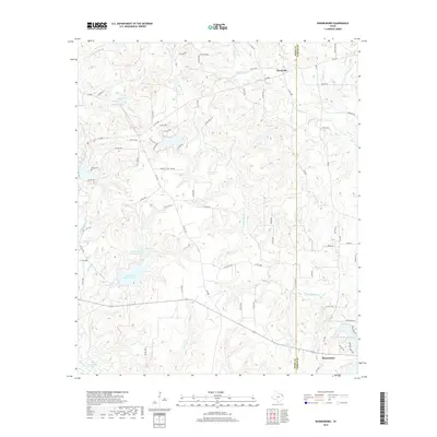
2019 Map of Rhonesboro
USGS Topo · Published 2019About this map
The borderlands of Wood Co and Upshur Co in East Texas center on the rural communities of Rhonesboro and Perryville. This landscape is defined by its intricate drainage networks, where Little Cypress Creek and Caney Creek weave through the timbered terrain. Historically rooted landmarks like the Smith Cem and Holly Springs indicate long-established local settlements, while the numerous private road designations and agricultural holdings such as Brockett Tree Farm RD suggest a modern reliance on forestry and private land management. Water is a dominant feature of the region, evidenced by significant reservoirs including Gunstream Lake Number 1 and Gunstream Lake Number 2 in the west, and Upper Raintree Lake near the southeastern corner, supporting local recreation and water management in this verdant corner of the state.
Find a feature on this map
85 named features on this map. Tap any name to fly to it.
Don’t see what you’re looking for? This feature index may not catch every label — zoom into the map to look around manually.
Map Details
Editions of this 2019 Rhonesboro Map
This is the sole edition of this map. No revisions or reprints were ever made.
Other maps of this area

1956 · Tyler
USGS Topo · 1:250,000

1960 · Shady Grove
USGS Topo · 1:24,000

1960 · Pritchett
USGS Topo · 1:24,000

1960 · Hainesville
USGS Topo · 1:24,000

1960 · Winnsboro
USGS Topo · 1:24,000

1960 · Cartwright
USGS Topo · 1:24,000

1960 · Thomas
USGS Topo · 1:24,000

1960 · Newsome
USGS Topo · 1:24,000

1960 · Leesburg
USGS Topo · 1:24,000

1960 · Rhonesboro
USGS Topo · 1:24,000