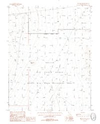
1987 Map of Rhyolite Knob
USGS Topo · Published 1988About this map
Rhyolite Knob rises above a landscape defined by military and federal management in this late-1980s survey of Nye County. The terrain is characterized by the expansive Kawich Depression and the volcanic formations of Lava Ridge. This quadrangle is dominated by the Nellis Air Force Range, including a designated Restricted Access Area that bisects the northern half of the map. The influence of the Bureau of Land Management is evident through the Nevada Wild Horse Management Area, which covers the southern portion of the sheet. Survey markers like Tower 40 Ft and Tower 30 Ft provide vertical reference points in this high-desert basin, while several transmission lines indicate the infrastructure supporting these remote government operations.
Find a feature on this map
9 named features on this map. Tap any name to fly to it.
Don’t see what you’re looking for? This feature index may not catch every label — zoom into the map to look around manually.
Map Details
Editions of this 1987 Rhyolite Knob Map
This is the sole edition of this map. No revisions or reprints were ever made.
Other maps of this area

1908 · Kawich
USGS Topo · 1:250,000

1942 · Reveille Peak
USGS Topo · 1:125,000

1952 · Kawich Peak
USGS Topo · 1:62,500

1952 · Quartzite Mtn
USGS Topo · 1:62,500

1952 · Reveille Peak
USGS Topo · 1:62,500

1952 · Belted Peak
USGS Topo · 1:62,500

1954 · Goldfield
USGS Topo · 1:250,000

1955 · Goldfield
USGS Topo · 1:250,000

1958 · Goldfield
USGS Topo · 1:250,000

1962 · Goldfield
USGS Topo · 1:250,000