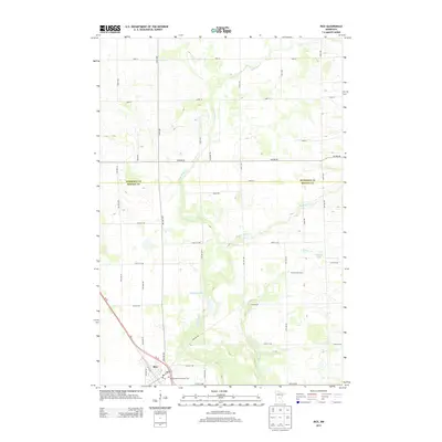
2013 Map of Rice
USGS Topo · Published 2013About this map
Rice stands as the primary settlement on this 2013 survey, situated where the local road network converges in the southwestern corner of the quadrangle. The town center is marked by essential local landmarks including the Po and the Inmaculate Conception Cem, reflecting the area's established community roots. The surrounding landscape is defined by a dense grid of rural routes such as Nature Rd and Angus Rd, which partition the territory between agricultural operations like the Pine Stream Dairy and natural drainage systems.
Find a feature on this map
52 named features on this map. Tap any name to fly to it.
Don’t see what you’re looking for? This feature index may not catch every label — zoom into the map to look around manually.
Map Details
Editions of this 2013 Rice Map
This is the sole edition of this map. No revisions or reprints were ever made.
Other maps of this area

1948 · Pierz
USGS Topo · 1:62,500

1948 · Little Falls
USGS Topo · 1:62,500

1950 · Little Falls
USGS Topo · 1:62,500

1950 · Pierz
USGS Topo · 1:62,500

1950 · St. Cloud
USGS Topo · 1:62,500

1953 · Saint Cloud
USGS Topo · 1:250,000

1957 · Saint Cloud
USGS Topo · 1:250,000

1958 · Saint Cloud
USGS Topo · 1:250,000

1965 · St Stephen
USGS Topo · 1:24,000
1974 · Mayhew
USGS Topo · 1:24,000