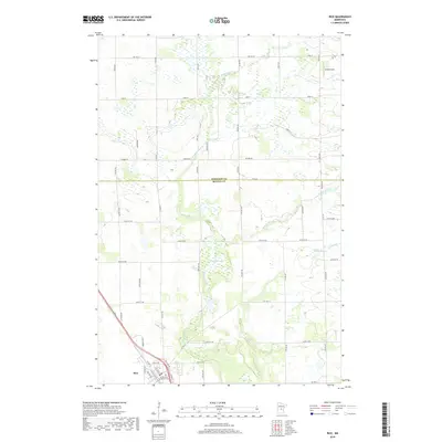
2019 Map of Rice
USGS Topo · Published 2019About this map
The city of Rice anchors the southwestern corner of this landscape, where the local street grid transitions into the expansive agricultural sections of both Benton and Morrison counties. This area is defined by its complex hydrography, featuring the sprawling Sartell Swamp and the meandering path of Little Rock Creek, which drains toward the Mississippi River basin. For those researching local heritage, the Immaculate Conception Cemetery stands as a primary landmark just southeast of the town center. The map also documents the rural infrastructure of the late 2010s, including Britz Airport in the northeast and a dense network of township and county roads like Nature Road and County Highway 21 that connect the isolated farmsteads and wetlands of this central Minnesota region.
Find a feature on this map
59 named features on this map. Tap any name to fly to it.
Don’t see what you’re looking for? This feature index may not catch every label — zoom into the map to look around manually.
Map Details
Editions of this 2019 Rice Map
This is the sole edition of this map. No revisions or reprints were ever made.
Other maps of this area

1948 · Pierz
USGS Topo · 1:62,500

1948 · Little Falls
USGS Topo · 1:62,500

1950 · Little Falls
USGS Topo · 1:62,500

1950 · Pierz
USGS Topo · 1:62,500

1950 · St. Cloud
USGS Topo · 1:62,500

1953 · Saint Cloud
USGS Topo · 1:250,000

1957 · Saint Cloud
USGS Topo · 1:250,000

1958 · Saint Cloud
USGS Topo · 1:250,000

1965 · St Stephen
USGS Topo · 1:24,000
1974 · Mayhew
USGS Topo · 1:24,000