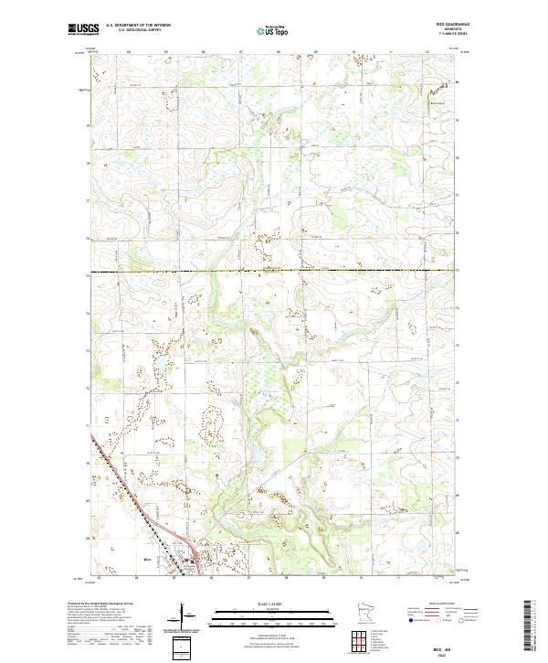
2022 Map of Rice
USGS Topo · Published 2022About this map
Rice stands as the primary settlement on this landscape, positioned where the transport network of Co Hwy 31 and local roads meet. The terrain is defined by a complex drainage system flowing toward the Mississippi River, characterized by the winding path of Little Rock Cr and the significant wetland expanse of Sartell Swamp. Along the southern edge of the village, the Immaculate Conception Cem serves as a key landmark for local genealogical research and historical community placement.
Find a feature on this map
35 named features on this map. Tap any name to fly to it.
Don’t see what you’re looking for? This feature index may not catch every label — zoom into the map to look around manually.
Map Details
Editions of this 2022 Rice Map
This is the sole edition of this map. No revisions or reprints were ever made.
Other maps of this area

1948 · Pierz
USGS Topo · 1:62,500

1948 · Little Falls
USGS Topo · 1:62,500

1950 · Little Falls
USGS Topo · 1:62,500

1950 · Pierz
USGS Topo · 1:62,500

1950 · St. Cloud
USGS Topo · 1:62,500

1953 · Saint Cloud
USGS Topo · 1:250,000

1957 · Saint Cloud
USGS Topo · 1:250,000

1958 · Saint Cloud
USGS Topo · 1:250,000

1965 · St Stephen
USGS Topo · 1:24,000
1974 · Mayhew
USGS Topo · 1:24,000