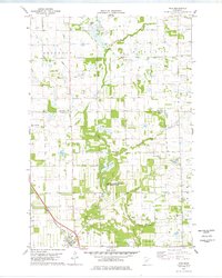
1978 Map of Rice
USGS Topo · Published 1978About this map
The village of Rice anchors the southwestern corner of this late-1970s landscape, situated along the Burlington Northern railroad corridor. The area is defined by a complex drainage network where Rock Creek, Little Rock Creek, and Zuleger Creek meander through a mix of agricultural fields and extensive wetlands. A significant portion of the central terrain is dedicated to the Sartell State Wildlife Management Area and the adjacent Sartell Swamp, reflecting the region's preservation of natural habitat amidst rural development.
Find a feature on this map
19 named features on this map. Tap any name to fly to it.
Don’t see what you’re looking for? This feature index may not catch every label — zoom into the map to look around manually.
Map Details
Editions of this 1978 Rice Map
This is the sole edition of this map. No revisions or reprints were ever made.
Other maps of this area

1948 · Pierz
USGS Topo · 1:62,500

1948 · Little Falls
USGS Topo · 1:62,500

1950 · Little Falls
USGS Topo · 1:62,500

1950 · Pierz
USGS Topo · 1:62,500

1950 · St. Cloud
USGS Topo · 1:62,500

1953 · Saint Cloud
USGS Topo · 1:250,000

1957 · Saint Cloud
USGS Topo · 1:250,000

1958 · Saint Cloud
USGS Topo · 1:250,000

1965 · St Stephen
USGS Topo · 1:24,000
1974 · Mayhew
USGS Topo · 1:24,000