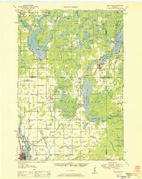
1951 Map of Rice Lake
USGS Topo · Published 1951About this map
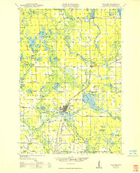
The glacial landscape of northwest Wisconsin is defined here by a dense concentration of water bodies, including Long Lake, Cedar Lake, and Balsam Lake. Compiled from 1948 aerial photography, this survey captures the rural infrastructure of the early 1950s, characterized by a high density of country schools such as Fadness Sch, Ulysses Sch, and Marquette Sch. The industrial and transport history of the region is visible through the Chicago And North Western railroad line connecting the town of Rice Lake northward through Brill and Birchwood. An Old Railroad Grade reflects shifting transportation priorities, while the Rice Lake Municipal Airport signals the era's modern expansion. Numerous small settlements like Mikana, Angus, and Dobie are shown with their local landmarks, including the Fenton Lake Lookout Tower and various town halls, providing a clear picture of community organization before later 20th-century consolidation.
Find a feature on this map
109 named features on this map. Tap any name to fly to it.
Don’t see what you’re looking for? This feature index may not catch every label — zoom into the map to look around manually.
Map Details
Editions of this 1951 Rice Lake Map
This is the sole edition of this map. No revisions or reprints were ever made.
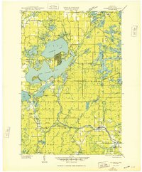
Other maps of this area

1944 · Couderay
USGS Topo · 1:48,000

1945 · Meteor
USGS Topo · 1:48,000
1948 · Couderay
USGS Topo · 1:48,000
1948 · Spooner
USGS Topo · 1:48,000
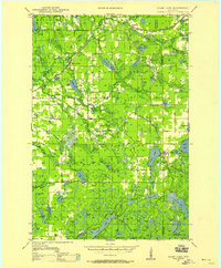
1948 · Stone Lake
USGS Topo · 1:48,000

1948 · Weyerhauser
USGS Topo · 1:48,000

1949 · Meteor
USGS Topo · 1:48,000
1949 · Spooner
USGS Topo · 1:48,000

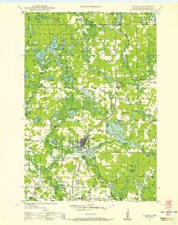
1949 · Rice Lake
USGS Topo · 1:48,000

1950 · Weyerhauser
USGS Topo · 1:48,000