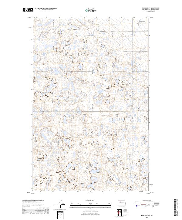
2024 Map of Rice Lake NW
USGS Topo · Published 2024About this map
Ward County Waterfowl Production Area dominates the southern half of this landscape in Ward County, characterized by a dense network of glacial potholes and wetlands. The terrain is defined by its depressions and small water bodies, a hallmark of the prairie pothole region, which are critical for local wildlife management. The grid of county roads, including Co Hwy 11 and various numbered streets like 254th St NW and 54th Ave SW, provides a window into the land's systematic division under the Public Land Survey System, as seen in the clear markers for t155n r86w and adjacent townships. To the north, the terrain begins to drain toward Lloyds Coulee, showing the transition from wetland basins to established surface drainage. This map is a valuable resource for understanding the preservation of natural habitats within an area otherwise governed by section-line roads and agricultural land divisions.
Find a feature on this map
17 named features on this map. Tap any name to fly to it.
Don’t see what you’re looking for? This feature index may not catch every label — zoom into the map to look around manually.
Map Details
Editions of this 2024 Rice Lake NW Map
This is the sole edition of this map. No revisions or reprints were ever made.
Other maps of this area

1950 · Des Lacs
USGS Topo · 1:24,000

1954 · Minot
USGS Topo · 1:250,000

1958 · Minot
USGS Topo · 1:250,000

1980 · Minot
USGS Topo · 1:100,000

1980 · Plaza SE
USGS Topo · 1:24,000

1980 · Rice Lake NW
USGS Topo · 1:24,000

1980 · Tagus SE
USGS Topo · 1:24,000
1980 · Berthold
USGS Topo · 1:24,000
1980 · Underdahl Lake
USGS Topo · 1:24,000
1980 · Mork Lake
USGS Topo · 1:24,000