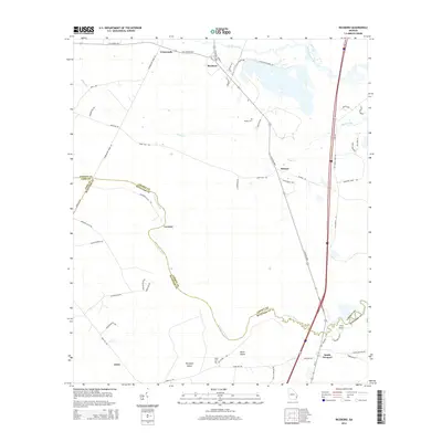
2014 Map of Riceboro
USGS Topo · Published 2014About this map
Riceboro and the winding corridor of the S Newport River anchor this 2014 study of the Georgia coast. The settlement pattern follows historical road networks and river bends, with clusters of development at South Newport and the inland hamlet of Crossroads. The landscape is defined by its transition from tidal waters to interior pine land, evidenced by features like Horsepen Island and Black Island surrounded by the river's meandering path. Local history is preserved in the location of Pando Cem and Davis Cem, while old thoroughfares like Barrington Ferry Rd and Hampton Ferry Rd hint at the area's maritime and ferry-dependent past. Near the northern edge, industrial infrastructure appears at Interstate Paper Rd, contrasting with the more traditional land use around Retreat and the riverfront at Fort Point.
Find a feature on this map
57 named features on this map. Tap any name to fly to it.
Don’t see what you’re looking for? This feature index may not catch every label — zoom into the map to look around manually.
Map Details
Editions of this 2014 Riceboro Map
This is the sole edition of this map. No revisions or reprints were ever made.
Other maps of this area

1918 · Hinesville
USGS Topo · 1:62,500

1920 · Sapelo River
USGS Topo · 1:62,500

1920 · Limerick
USGS Topo · 1:62,500

1943 · Ludowici
USGS Topo · 1:62,500

1943 · Sapelo River
USGS Topo · 1:62,500

1944 · Hinesville
USGS Topo · 1:62,500

1944 · Limerick
USGS Topo · 1:62,500

1945 · Sapelo River
USGS Topo · 1:62,500

1946 · Brunswick
USGS Topo · 1:250,000

1948 · Brunswick
USGS Topo · 1:250,000