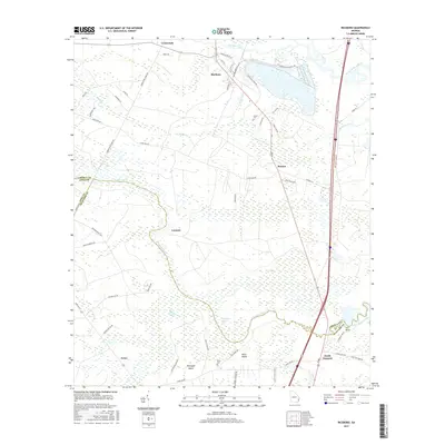
2017 Map of Riceboro
USGS Topo · Published 2017About this map
Riceboro stands at the northern edge of this coastal Georgia landscape, where industrial infrastructure like Interstate Paper Rd and the Chemical Plant Rd meet the complex hydrology of the Lowcountry. The map reveals a region defined by the winding paths of the North Newport River and the S Newport River, which encircle vast wetland systems including Big Mortar Swamp and Bull Town Swamp. This 2017 survey documents the transition from the concentrated settlement at Riceboro to the more dispersed communities of Retreat and South Newport to the south. Local heritage is preserved in the location of the Pando Cem and Davis Cem, while topographic names like Horsepen Island and Black Island indicate higher ground amidst the tidal marsh environment. The geography is bisected by Interstate 95, illustrating the modern corridor's path through a territory historically reliant on water routes and timber.
Find a feature on this map
61 named features on this map. Tap any name to fly to it.
Don’t see what you’re looking for? This feature index may not catch every label — zoom into the map to look around manually.
Map Details
Editions of this 2017 Riceboro Map
This is the sole edition of this map. No revisions or reprints were ever made.
Other maps of this area

1918 · Hinesville
USGS Topo · 1:62,500

1920 · Sapelo River
USGS Topo · 1:62,500

1920 · Limerick
USGS Topo · 1:62,500

1943 · Ludowici
USGS Topo · 1:62,500

1943 · Sapelo River
USGS Topo · 1:62,500

1944 · Hinesville
USGS Topo · 1:62,500

1944 · Limerick
USGS Topo · 1:62,500

1945 · Sapelo River
USGS Topo · 1:62,500

1946 · Brunswick
USGS Topo · 1:250,000

1948 · Brunswick
USGS Topo · 1:250,000