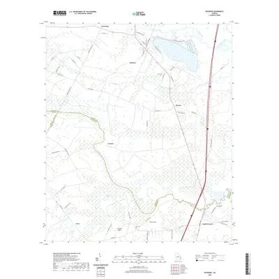
2020 Map of Riceboro
USGS Topo · Published 2020About this map
Riceboro serves as the focal point for this coastal Georgia landscape, where the tides of the North Newport River and South Newport River meet a dense network of wetlands. The map documents a rural corridor transitioning between the high grounds of Black Island and the expansive reaches of Big Mortar Swamp and Bull Town Swamp. In the north, industrial footprints such as Interstate Papermill Rd stand alongside long-established settlements like Retreat and Crossroads. Genealogists and local historians will find value in the identification of family-linked landmarks such as Pando Cem and Davis Cem, which provide a geographic anchor for the families of Liberty and McIntosh counties. The intricate road network, including names like Barrington Ferry Rd and Boy Scout Camp RD, illustrates how modern infrastructure has laid over the historical paths that once connected these riverine communities.
Find a feature on this map
59 named features on this map. Tap any name to fly to it.
Don’t see what you’re looking for? This feature index may not catch every label — zoom into the map to look around manually.
Map Details
Editions of this 2020 Riceboro Map
This is the sole edition of this map. No revisions or reprints were ever made.
Other maps of this area

1918 · Hinesville
USGS Topo · 1:62,500

1920 · Sapelo River
USGS Topo · 1:62,500

1920 · Limerick
USGS Topo · 1:62,500

1943 · Ludowici
USGS Topo · 1:62,500

1943 · Sapelo River
USGS Topo · 1:62,500

1944 · Hinesville
USGS Topo · 1:62,500

1944 · Limerick
USGS Topo · 1:62,500

1945 · Sapelo River
USGS Topo · 1:62,500

1946 · Brunswick
USGS Topo · 1:250,000

1948 · Brunswick
USGS Topo · 1:250,000