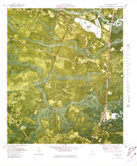
1980 Map of Riceboro
USGS Topo · Published 1980About this map
Riceboro stands at the northern edge of this coastal landscape where the Seaboard Coast Line railroad cuts a straight path south toward the MC Intosh Co line. This 1980 orthophotomap provides a rare hybrid view of the Georgia lowcountry, combining traditional topographic contours with aerial imagery that reveals the vast, saturated expanses of Bull Town Swamp and Mortar Swamp. These wetlands dictate the settlement patterns, forcing small communities like Lecount, Ponsell, and Wayland to occupy the higher, drier ground between the drainage basins of the North Newport River and the South Newport River.
Find a feature on this map
35 named features on this map. Tap any name to fly to it.
Don’t see what you’re looking for? This feature index may not catch every label — zoom into the map to look around manually.
Map Details
Editions of this 1980 Riceboro Map
This is the sole edition of this map. No revisions or reprints were ever made.
Other maps of this area

1918 · Hinesville
USGS Topo · 1:62,500

1920 · Sapelo River
USGS Topo · 1:62,500

1920 · Limerick
USGS Topo · 1:62,500

1943 · Ludowici
USGS Topo · 1:62,500

1943 · Sapelo River
USGS Topo · 1:62,500

1944 · Hinesville
USGS Topo · 1:62,500

1944 · Limerick
USGS Topo · 1:62,500

1945 · Sapelo River
USGS Topo · 1:62,500

1946 · Brunswick
USGS Topo · 1:250,000

1948 · Brunswick
USGS Topo · 1:250,000