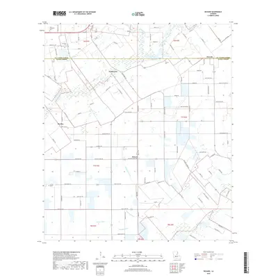
2018 Map of Richard
USGS Topo · Published 2018About this map
The boundary between St. Landry Parish and Acadia Parish bisects this agricultural landscape, where the settlements of Pitreville, Prudhomme, and Richard are connected by a network of rural roads. The terrain is defined by a system of natural drainages, most notably Blaise Lejeune Gully, Cole Gully, and Prather Gully, which snake through the prairie. For genealogists and local historians, the map is remarkably dense with burial sites, including Mount Calvary Cem, Mowata Cem, Courtville Cem, and several others like Odon Cem and Carron Cem. This 2018 survey reveals a modern rural community that maintains its historical spatial structure, with family-named landmarks like Donaut Guillory Rd and Vidrine Rd reflecting the deep roots of the local population in this part of southwest Louisiana.
Find a feature on this map
100 named features on this map. Tap any name to fly to it.
Don’t see what you’re looking for? This feature index may not catch every label — zoom into the map to look around manually.
Map Details
Editions of this 2018 Richard Map
This is the sole edition of this map. No revisions or reprints were ever made.
Other maps of this area

1935 · Branch
USGS Topo · 1:31,680

1939 · Opelousas
USGS Topo · 1:62,500

1947 · Branch
USGS Topo · 1:31,680

1947 · Redland
USGS Topo · 1:31,680

1947 · Chataignier
USGS Topo · 1:31,680

1947 · Eunice
USGS Topo · 1:31,680

1947 · Iota
USGS Topo · 1:31,680

1947 · Pitreville
USGS Topo · 1:31,680

1952 · Lake Charles
USGS Topo · 1:250,000

1954 · Lake Charles
USGS Topo · 1:250,000