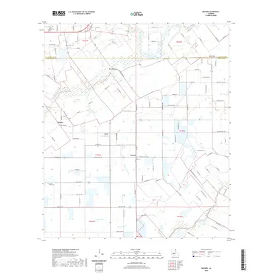
2020 Map of Richard
USGS Topo · Published 2020About this map
The boundary between St. Landry and Acadia Parishes defines this rural landscape, where agriculture is shaped by a network of drainage gullies like Blaise Lejeune Gully and Hazelwood Gully. The settlement of Richard serves as a local hub, anchored by the Saint Edward Cemetery and the thoroughfare of Richard School Road. This 2020 survey reveals a community deeply rooted in its local geography, with numerous family-named landmarks and cemeteries such as Courville Cemetery and Fruge Cemetery scattered across the township lines. The transition between t6s r1e and t7s r2e illustrates the persistent influence of the Public Land Survey System on modern Louisiana land use. Small aviation infrastructure is represented by the Prop Stop Airport, while the smaller communities of Prudhomme, Pitreville, and Hundley mark the intersections of a dense network of parish roads and state highways like La 95.
Find a feature on this map
145 named features on this map. Tap any name to fly to it.
Don’t see what you’re looking for? This feature index may not catch every label — zoom into the map to look around manually.
Map Details
Editions of this 2020 Richard Map
This is the sole edition of this map. No revisions or reprints were ever made.
Other maps of this area

1935 · Branch
USGS Topo · 1:31,680

1939 · Opelousas
USGS Topo · 1:62,500

1947 · Branch
USGS Topo · 1:31,680

1947 · Redland
USGS Topo · 1:31,680

1947 · Chataignier
USGS Topo · 1:31,680

1947 · Eunice
USGS Topo · 1:31,680

1947 · Iota
USGS Topo · 1:31,680

1947 · Pitreville
USGS Topo · 1:31,680

1952 · Lake Charles
USGS Topo · 1:250,000

1954 · Lake Charles
USGS Topo · 1:250,000