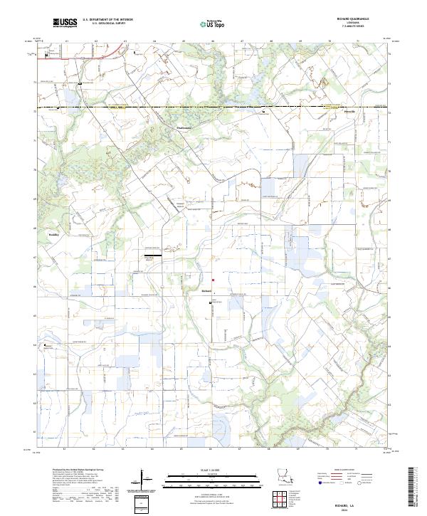
2024 Map of Richard
USGS Topo · Published 2024About this map
The low-lying plains of Acadia Parish and St. Landry Parish are defined by a rhythmic pattern of agricultural fields and drainage gullies in this modern topographic study. The landscape is anchored by small crossroads settlements including Prudhomme, Richard, and Pitreville, where the road network transitions from the rigid section lines of the Public Land Survey System to diagonal routes like Pointe Noir Rd and Roxie Hwy. For those researching family history, the map preserves the locations of several burial grounds, such as Saint Edward Cem and Mount Calvary Cem, often located near parish boundaries.
Find a feature on this map
117 named features on this map. Tap any name to fly to it.
Don’t see what you’re looking for? This feature index may not catch every label — zoom into the map to look around manually.
Map Details
Editions of this 2024 Richard Map
This is the sole edition of this map. No revisions or reprints were ever made.
Other maps of this area

1935 · Branch
USGS Topo · 1:31,680

1939 · Opelousas
USGS Topo · 1:62,500

1947 · Branch
USGS Topo · 1:31,680

1947 · Redland
USGS Topo · 1:31,680

1947 · Chataignier
USGS Topo · 1:31,680

1947 · Eunice
USGS Topo · 1:31,680

1947 · Iota
USGS Topo · 1:31,680

1947 · Pitreville
USGS Topo · 1:31,680

1952 · Lake Charles
USGS Topo · 1:250,000

1954 · Lake Charles
USGS Topo · 1:250,000