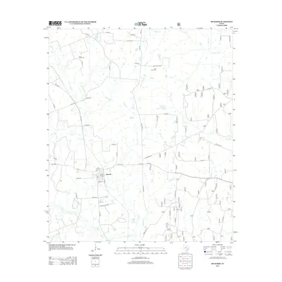
2013 Map of Richards
USGS Topo · Published 2013About this map
Richards serves as the central hub for this portion of Grimes County, where a grid of streets including Sand St, Lynn St, and Hickory St meets the rural road network. The surrounding landscape is defined by a dense web of watercourses, most notably Lake Cr and Caney Cr, which drain the timbered terrain. This 2013 survey provides a clear look at the local genealogy markers of the area, specifically the David Chapel Cem in the north, Bays Chapel Cem near Bays Cemetary Rd, and Fairview Cem to the west. The layout of the region is further shaped by the numerous creek branches like Kidhaw Br and Bay Br, which cross beneath farm-to-market roads and county routes that have long connected these rural communities.
Find a feature on this map
53 named features on this map. Tap any name to fly to it.
Don’t see what you’re looking for? This feature index may not catch every label — zoom into the map to look around manually.
Map Details
Editions of this 2013 Richards Map
This is the sole edition of this map. No revisions or reprints were ever made.
Other maps of this area

1954 · Beaumont
USGS Topo · 1:250,000

1957 · Beaumont
USGS Topo · 1:250,000

1959 · San Jacinto
USGS Topo · 1:24,000

1959 · Montgomery
USGS Topo · 1:24,000

1961 · Anderson
USGS Topo · 1:24,000

1961 · Singleton
USGS Topo · 1:24,000

1962 · Dacus
USGS Topo · 1:24,000

1962 · Richards
USGS Topo · 1:24,000
1962 · Roans Prairie
USGS Topo · 1:24,000

1962 · Galilee
USGS Topo · 1:24,000